Essays on the people, buildings, and events in the conjoined histories of East Lansing and Michigan State University, with a particular interest in the Michigan Agricultural College era (1855–1925), and a timeline of significant events.
Featured Post
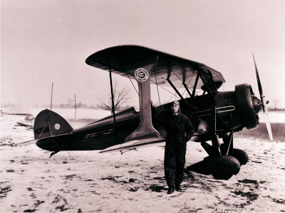
The lost airfields of East Lansing
Arthur J. ‘Art’ Davis (1895–1979, M.A.C. ’23) was a legendary Michigan aviator. His career, a mix of barnstorming, air racing, skywriting, pilot training, and wartime service, embodies the adventurous spirit of early aviation. During his lifetime, he established three different airfields in and around East Lansing—none of which are apparent today. Read More. →