Essays on the people, buildings, and events in the conjoined histories of East Lansing and Michigan State University, with a particular interest in the Michigan Agricultural College era (1855–1925), and a timeline of significant events.
Featured Post
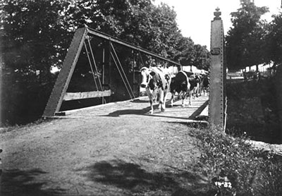
Farm Lane
The Farm Lane bridge—the fifth on its site—roughly marks the centerpoint of the Michigan State University campus. The lane itself is one of the oldest roads on campus, named for its original role as the access road to the Agricultural College farm, and even today it runs into the heart of MSU farmland. Read More. →